Map - Masvingo

Masvingo
Masvingo is a city in south-eastern Zimbabwe and the capital of Masvingo Province. The city is situated close to Great Zimbabwe, the national monument from which the country takes its name and close to Lake Mutirikwi, its recreational park, the Kyle dam and the Kyle National Reserve where there are many different animal species. It is mostly populated by the Karanga people who form the biggest branch of the various Shona tribes in Zimbabwe.

The city was known as Fort Victoria until 1982, when its name was briefly changed to Nyanda, after a mountain about 10 kilometres south of the town, on the Masvingo to Beitbridge Road. That led to protests, because "nyanda" means "one who has lice", and public sentiment was that Masvingo would be more reflective of the history of the city. Within a few months, the name was changed to Masvingo, which means "fort" in Shona, and the Great Zimbabwe, which is essentially a walled fort, is often referred to as "Masvingo eZimbabwe" or sometime "Masvingo eVitori," meaning "the fort near Fort Victoria".

Masvingo is the oldest colonial settlement in Zimbabwe, and developed around an encampment established in 1890, when the British South Africa Company "Pioneer Column" of the first European colonists passed through on their way to what became Salisbury, now Harare. The Old Fort national monument is located in the centre of town, and was erected in 1891 as one of a series of fortifications to guard the route from Salisbury to the south. The very first cricket match in Zimbabwe is said to have taken place close by, in 1890.

 
Map - Masvingo
Map
Google Earth - Map - Masvingo
Google Earth
Openstreetmap - Map - Masvingo
Openstreetmap
Map - Masvingo - Esri.WorldImagery
Esri.WorldImagery
Map - Masvingo - Esri.WorldStreetMap
Esri.WorldStreetMap
Map - Masvingo - OpenStreetMap.Mapnik
OpenStreetMap.Mapnik
Map - Masvingo - OpenStreetMap.HOT
OpenStreetMap.HOT
Map - Masvingo - OpenTopoMap
OpenTopoMap
Map - Masvingo - CartoDB.Positron
CartoDB.Positron
Map - Masvingo - CartoDB.Voyager
CartoDB.Voyager
Map - Masvingo - OpenMapSurfer.Roads
OpenMapSurfer.Roads
Map - Masvingo - Esri.WorldTopoMap
Esri.WorldTopoMap
Map - Masvingo - Stamen.TonerLite
Stamen.TonerLite
Country - Zimbabwe
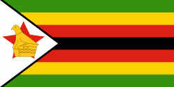
Flag of Zimbabwe
Zimbabwe, officially the Republic of Zimbabwe, is a landlocked country in Southern Africa, between the Zambezi and Limpopo Rivers, bordered by South Africa to the south, Botswana to the south-west, Zambia to the north, and Mozambique to the east. The capital and largest city is Harare. The second largest city is Bulawayo. A country of roughly 15 million people, Zimbabwe has 16 official languages, with English, Shona, and Ndebele the most common. Beginning in the 9th century, during its late Iron Age, the Bantu people (who would become the ethnic Shona) built the city-state of Great Zimbabwe; the city-state became one of the major African trade centres by the 11th century, controlling the gold, ivory and copper trades with the Swahili coast, which were connected to Arab and Indian states. By the mid 15th century, the city-state had been abandoned. From there, the Kingdom of Zimbabwe was established, followed by the Rozvi and Mutapa empires.

The British South Africa Company of Cecil Rhodes demarcated the Rhodesia region in 1890 when they conquered Mashonaland and later in 1893 Matabeleland after a fierce resistance by Matabele people known as the First Matabele War. Company rule ended in 1923 with the establishment of Southern Rhodesia as a self-governing British colony. In 1965, the white minority government unilaterally declared independence as Rhodesia. The state endured international isolation and a 15-year guerrilla war with black nationalist forces; this culminated in a peace agreement that established universal enfranchisement and de jure sovereignty as Zimbabwe in April 1980. Zimbabwe then joined the Commonwealth of Nations, from which it was suspended in 2002 for breaches of international law by its government under Robert Mugabe and from which it withdrew in December 2003.
Currency / Language  
ISO Currency Symbol Significant figures
ZWL Zimbabwean dollar 2
ISO Language
SN Shona language
Neighbourhood - Country  
  •  Botswana 
  •  Mozambique 
  •  South Africa 
  •  Zambia